
Distance between Yusufeli and Glyfáda
Distance from Yusufeli to Glyfáda is 970 miles / 1561 kilometers.
Map showing the distance from Yusufeli to Glyfáda
| Air distance: | miles km |


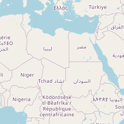


Leaflet | © OpenStreetMap contributors
Time difference between Yusufeli and Glyfáda
The time difference between Yusufeli and Glyfáda is 1 hour. Glyfáda is 1 hour behind Yusufeli. Current local time in Yusufeli is 23:07 +03 (2025-01-27) and time in Glyfáda is 22:07 EET (2025-01-27).