
Distance between Vilca and Marabá
Distance from Vilca to Marabá is 1843 miles / 2966 kilometers.
Map showing the distance from Vilca to Marabá
| Air distance: | miles km |

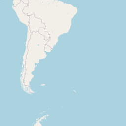

Leaflet | © OpenStreetMap contributors
Time difference between Vilca and Marabá
The time difference between Vilca and Marabá is 2 hours. Marabá is 2 hours ahead of Vilca. Current local time in Vilca is 14:25 -05 (2025-01-28) and time in Marabá is 16:25 -03 (2025-01-28).