Distance between Tall ‘Afar and Tonekābon
Distance from Tall ‘Afar to Tonekābon is 468 miles / 754 kilometers.
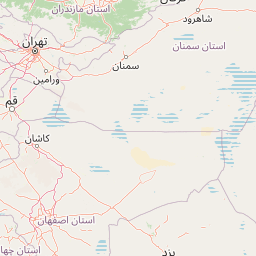
Map showing the distance from Tall ‘Afar to Tonekābon
![]() |
Air distance: | miles km |
![](https://tile.openstreetmap.org/6/39/24.png)
![](https://tile.openstreetmap.org/6/40/24.png)
![](https://tile.openstreetmap.org/6/39/25.png)
![](https://tile.openstreetmap.org/6/40/25.png)
![](https://tile.openstreetmap.org/6/38/24.png)
![](https://tile.openstreetmap.org/6/41/24.png)
![](https://tile.openstreetmap.org/6/38/25.png)
![](https://tile.openstreetmap.org/6/41/25.png)
![](https://tile.openstreetmap.org/6/37/24.png)
![](https://tile.openstreetmap.org/6/42/24.png)
![](https://tile.openstreetmap.org/6/37/25.png)
![](https://tile.openstreetmap.org/6/42/25.png)
![](marker-shadow.png)
![](marker-icon.png)
Leaflet | © OpenStreetMap contributors
Tall ‘Afar
City: | Tall ‘Afar |
Country: | Iraq |
Tonekābon
City: | Tonekābon |
Country: | Iran |
Time difference between Tall ‘Afar and Tonekābon
The time difference between Tall ‘Afar and Tonekābon is 30 minutes. Tonekābon is 30 minutes ahead of Tall ‘Afar. Current local time in Tall ‘Afar is 02:53 +03 (2025-02-18) and time in Tonekābon is 03:23 +0330 (2025-02-18).