
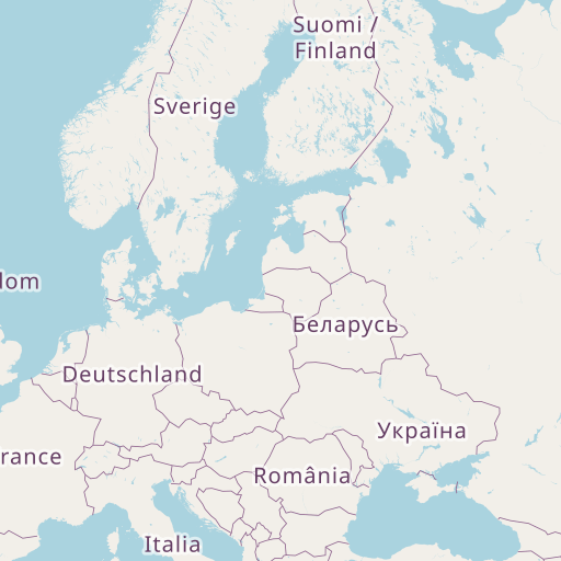
Distance between Saravale and Ostrava
Distance from Saravale to Ostrava is 284 miles / 457 kilometers.
Map showing the distance from Saravale to Ostrava
| Air distance: | miles km |

Leaflet | © OpenStreetMap contributors
Saravale
| City: | Saravale |
| Country: | Romania |
| Coordinates: |
46°4′9″N 20°44′27″E |
Ostrava
| City: | Ostrava |
| Country: | Czech Republic |
| Coordinates: |
49°50′4″N 18°16′55″E |
Time difference between Saravale and Ostrava
The time difference between Saravale and Ostrava is 1 hour. Ostrava is 1 hour behind Saravale. Current local time in Saravale is 05:31 EET (2024-12-04) and time in Ostrava is 04:31 CET (2024-12-04).