
Distance between Racoviţa and Cegléd
Distance from Racoviţa to Cegléd is 134 miles / 216 kilometers.
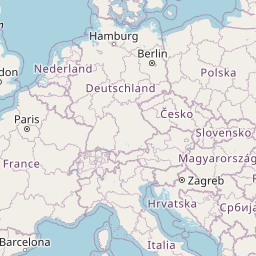
Map showing the distance from Racoviţa to Cegléd
| Air distance: | miles km |


Leaflet | © OpenStreetMap contributors
Racoviţa
| City: | Racoviţa |
| Country: | Romania |
| Coordinates: |
45°41′53″N 21°38′8″E |
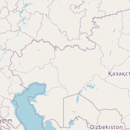
Cegléd
| City: | Cegléd |
| Country: | Hungary |
| Coordinates: |
47°10′21″N 19°47′58″E |
Time difference between Racoviţa and Cegléd
The time difference between Racoviţa and Cegléd is 1 hour. Cegléd is 1 hour behind Racoviţa. Current local time in Racoviţa is 11:55 EET (2025-01-16) and time in Cegléd is 10:55 CET (2025-01-16).