
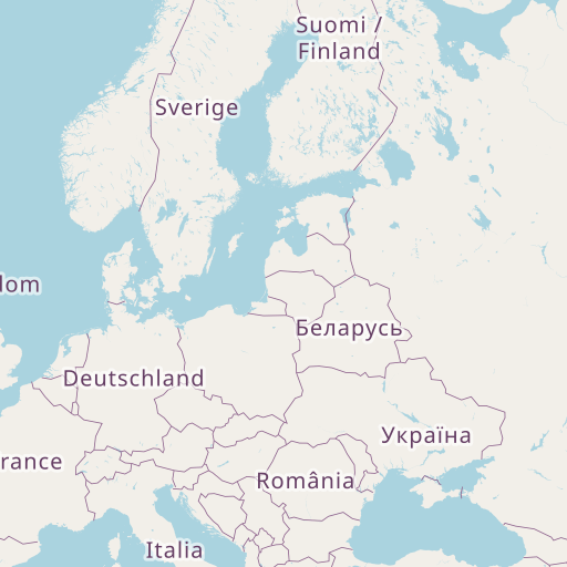
Distance between Podenii Noi and Boryslav
Distance from Podenii Noi to Boryslav is 315 miles / 508 kilometers.
Map showing the distance from Podenii Noi to Boryslav
| Air distance: | miles km |

Leaflet | © OpenStreetMap contributors
Podenii Noi
| City: | Podenii Noi |
| Country: | Romania |
| Coordinates: |
45°7′0″N 26°10′0″E |
Boryslav
| City: | Boryslav |
| Country: | Ukraine |
| Coordinates: |
49°17′12″N 23°25′56″E |
Time difference between Podenii Noi and Boryslav
There is no time difference between Podenii Noi and Boryslav. Current local time in Podenii Noi and Boryslav is 01:16 EET (2024-12-15)