
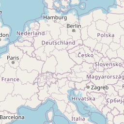
Distance between Periam and Eger
Distance from Periam to Eger is 130 miles / 209 kilometers.
Map showing the distance from Periam to Eger
| Air distance: | miles km |


Leaflet | © OpenStreetMap contributors
Periam
| City: | Periam |
| Country: | Romania |
| Coordinates: |
46°3′0″N 20°52′0″E |
Eger
| City: | Eger |
| Country: | Hungary |
| Coordinates: |
47°54′9″N 20°22′23″E |
Time difference between Periam and Eger
The time difference between Periam and Eger is 1 hour. Eger is 1 hour behind Periam. Current local time in Periam is 17:16 EET (2025-01-15) and time in Eger is 16:16 CET (2025-01-15).