
Distance between Obas and Santa Inês
Distance from Obas to Santa Inês is 2187 miles / 3519 kilometers.
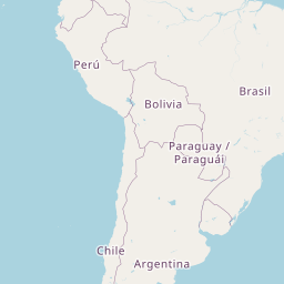
Map showing the distance from Obas to Santa Inês
| Air distance: | miles km |


Leaflet | © OpenStreetMap contributors
Obas
| City: | Obas |
| Country: | Peru |
Santa Inês
| City: | Santa Inês |
| Country: | Brazil |
Time difference between Obas and Santa Inês
The time difference between Obas and Santa Inês is 2 hours. Santa Inês is 2 hours ahead of Obas. Current local time in Obas is 10:42 -05 (2025-02-15) and time in Santa Inês is 12:42 -03 (2025-02-15).