
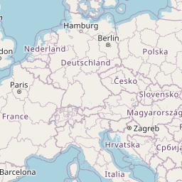
Distance between Lăpoș and Asti
Distance from Lăpoș to Asti is 886 miles / 1425 kilometers.
Map showing the distance from Lăpoș to Asti
| Air distance: | miles km |


Leaflet | © OpenStreetMap contributors
Lăpoș
| City: | Lăpoș |
| Country: | Romania |
| Coordinates: |
46°23′37″N 26°27′44″E |
Asti
| City: | Asti |
| Country: | Italy |
| Coordinates: |
44°54′5″N 8°12′27″E |
Time difference between Lăpoș and Asti
The time difference between Lăpoș and Asti is 1 hour. Asti is 1 hour behind Lăpoș. Current local time in Lăpoș is 11:47 EET (2025-01-16) and time in Asti is 10:47 CET (2025-01-16).