
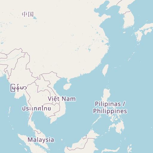
Distance between Guilin and Mudkhed
Distance from Guilin to Mudkhed is 2134 miles / 3434 kilometers.
Map showing the distance from Guilin to Mudkhed
| Air distance: | miles km |


Leaflet | © OpenStreetMap contributors
Guilin
| City: | Guilin |
| Country: | China |
| Coordinates: |
25°16′54″N 110°17′11″E |
Mudkhed
| City: | Mudkhed |
| Country: | India |
| Coordinates: |
19°9′23″N 77°30′10″E |
Time difference between Guilin and Mudkhed
The time difference between Guilin and Mudkhed is 2 hours 30 minutes. Mudkhed is 2 hours 30 minutes behind Guilin. Current local time in Guilin is 20:55 CST (2024-12-18) and time in Mudkhed is 18:25 IST (2024-12-18).