
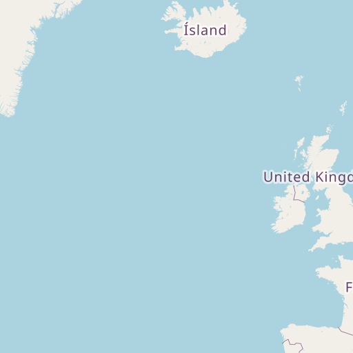
Distance between Garnich and Staveley
Distance from Garnich to Staveley is 403 miles / 648 kilometers.
Map showing the distance from Garnich to Staveley
| Air distance: | miles km |

Leaflet | © OpenStreetMap contributors
Garnich
| City: | Garnich |
| Country: | Luxembourg |
| Coordinates: |
49°37′0″N 5°57′9″E |
Staveley
| City: | Staveley |
| Country: | United Kingdom |
| Coordinates: |
53°16′0″N 1°21′0″W |
Time difference between Garnich and Staveley
The time difference between Garnich and Staveley is 1 hour. Staveley is 1 hour behind Garnich. Current local time in Garnich is 22:02 CET (2024-12-17) and time in Staveley is 21:02 GMT (2024-12-17).