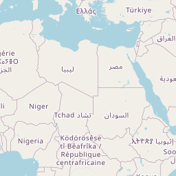
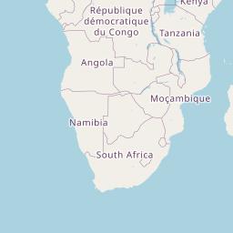
Distance between Adzopé and Mbandaka
Distance from Adzopé to Mbandaka is 1582 miles / 2546 kilometers.
Map showing the distance from Adzopé to Mbandaka
![]() |
Air distance: | miles km |
![](https://tile.openstreetmap.org/3/3/3.png)
![](https://tile.openstreetmap.org/3/4/3.png)
![](https://tile.openstreetmap.org/3/3/4.png)
![](https://tile.openstreetmap.org/3/4/4.png)
![](https://tile.openstreetmap.org/3/2/3.png)
![](https://tile.openstreetmap.org/3/5/3.png)
![](https://tile.openstreetmap.org/3/2/4.png)
![](https://tile.openstreetmap.org/3/5/4.png)
![](https://tile.openstreetmap.org/3/1/3.png)
![](https://tile.openstreetmap.org/3/6/3.png)
![](https://tile.openstreetmap.org/3/1/4.png)
![](https://tile.openstreetmap.org/3/6/4.png)
![](marker-shadow.png)
![](marker-icon.png)
Leaflet | © OpenStreetMap contributors
Adzopé
City: | Adzopé |
Country: | Ivory Coast |
Mbandaka
City: | Mbandaka |
Country: | Democratic Republic of the Congo |
Time difference between Adzopé and Mbandaka
The time difference between Adzopé and Mbandaka is 1 hour. Mbandaka is 1 hour ahead of Adzopé. Current local time in Adzopé is 16:34 GMT (2025-02-15) and time in Mbandaka is 17:34 WAT (2025-02-15).