
Cities close to Văn Quan
Cities, towns and suburbs near Văn Quan. Bình Gia: 21 kilometers (13 miles), Thị Trấn Na Sầm: 23 kilometers (14 miles), Bắc Sơn: 23 kilometers (14 miles).
| Cities / towns / suburbs around Văn Quan | Kilometers | Miles |
|---|---|---|
| How far is Bình Gia from Văn Quan | 21 | 13 |
| How far is Thị Trấn Na Sầm from Văn Quan | 23 | 14 |
| How far is Bắc Sơn from Văn Quan | 23 | 14 |
| How far is Thành Phố Lạng Sơn from Văn Quan | 23 | 14 |
| How far is Đồng Mỏ from Văn Quan | 23 | 15 |
| How far is Thị Trấn Cao Lộc from Văn Quan | 24 | 15 |
| How far is Lộc Bình from Văn Quan | 41 | 26 |
| How far is Thị Trấn Thất Khê from Văn Quan | 44 | 27 |
| How far is Hữu Lũng from Văn Quan | 45 | 28 |
| How far is Chũ from Văn Quan | 55 | 34 |
Closest airport to Văn Quan
| Airport | Kilometers | Miles |
|---|---|---|
| Noi Bai International Airport (HAN) | 104.3 | 64.8 |
| Cat Bi International Airport (HPH) | 118.0 | 73.3 |
| Van Don International Airport (VDO) | 123.0 | 76.4 |
Location
Coordinates:
Latitude: 21°51′54″N
Longitude: 106°32′21″E
Map
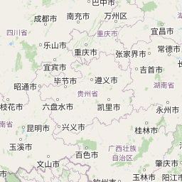


Leaflet | © OpenStreetMap contributors
Time
Current local time in Văn Quan:
Time: 17:38 +07
Date: 2025-03-20
Sunrise and Sunset
| Date | Sunrise | Sunset |
|---|---|---|
| 2025-03-20 (Today) | 05:56 | 18:05 |
| 2025-03-21 (Tomorrow) | 05:55 | 18:06 |
| 2025-03-22 | 05:54 | 18:06 |
| 2025-03-23 | 05:53 | 18:06 |
| 2025-03-24 | 05:52 | 18:07 |
| 2025-03-25 | 05:52 | 18:07 |
| 2025-03-26 | 05:51 | 18:07 |