
Cities close to Ngô Đồng
Cities, towns and suburbs near Ngô Đồng. Xuân Trường: 12 kilometers (7 miles), Thanh Nê: 12 kilometers (7 miles), Tiền Hải: 15 kilometers (9 miles).
| Cities / towns / suburbs around Ngô Đồng | Kilometers | Miles |
|---|---|---|
| How far is Xuân Trường from Ngô Đồng | 12 | 7 |
| How far is Thanh Nê from Ngô Đồng | 12 | 7 |
| How far is Tiền Hải from Ngô Đồng | 15 | 9 |
| How far is Yên Định from Ngô Đồng | 18 | 11 |
| How far is Cổ Lễ from Ngô Đồng | 19 | 12 |
| How far is Thành Phố Thái Bình from Ngô Đồng | 21 | 13 |
| How far is Vũ Thư from Ngô Đồng | 23 | 14 |
| How far is Lien De from Ngô Đồng | 28 | 17 |
| How far is Nam Giang from Ngô Đồng | 28 | 18 |
| How far is Đông Hưng from Ngô Đồng | 32 | 20 |
Closest airport to Ngô Đồng
| Airport | Kilometers | Miles |
|---|---|---|
| Cat Bi International Airport (HPH) | 66.5 | 41.3 |
| Noi Bai International Airport (HAN) | 123.7 | 76.9 |
| Van Don International Airport (VDO) | 137.3 | 85.3 |
Location
Coordinates:
Latitude: 20°16′58″N
Longitude: 106°26′36″E
Map


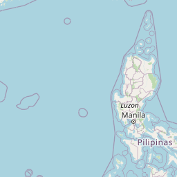


Leaflet | © OpenStreetMap contributors
Time
Current local time in Ngô Đồng:
Time: 21:43 +07
Date: 2025-03-21
Sunrise and Sunset
| Date | Sunrise | Sunset |
|---|---|---|
| 2025-03-21 (Today) | 05:56 | 18:06 |
| 2025-03-22 (Tomorrow) | 05:55 | 18:06 |
| 2025-03-23 | 05:54 | 18:07 |
| 2025-03-24 | 05:53 | 18:07 |
| 2025-03-25 | 05:52 | 18:07 |
| 2025-03-26 | 05:51 | 18:08 |
| 2025-03-27 | 05:50 | 18:08 |