
Cities close to Chúc Sơn
Cities, towns and suburbs near Chúc Sơn. Hà Đông: 10 kilometers (6 miles), Quốc Oai: 10 kilometers (6 miles), Kim Bài: 11 kilometers (7 miles).
| Cities / towns / suburbs around Chúc Sơn | Kilometers | Miles |
|---|---|---|
| How far is Hà Đông from Chúc Sơn | 10 | 6 |
| How far is Quốc Oai from Chúc Sơn | 10 | 6 |
| How far is Kim Bài from Chúc Sơn | 11 | 7 |
| How far is Thanh Xuân from Chúc Sơn | 13 | 8 |
| How far is Cầu Diễn from Chúc Sơn | 15 | 9 |
| How far is Văn Điển from Chúc Sơn | 15 | 9 |
| How far is Cầu Giấy from Chúc Sơn | 16 | 10 |
| How far is Trôi from Chúc Sơn | 16 | 10 |
| How far is Đống Đa from Chúc Sơn | 17 | 11 |
| How far is Thường Tín from Chúc Sơn | 18 | 11 |
Closest airport to Chúc Sơn
| Airport | Kilometers | Miles |
|---|---|---|
| Noi Bai International Airport (HAN) | 34.9 | 21.7 |
| Cat Bi International Airport (HPH) | 107.1 | 66.5 |
| Van Don International Airport (VDO) | 179.3 | 111.4 |
Location
Coordinates:
Latitude: 20°55′25″N
Longitude: 105°42′5″E
Map


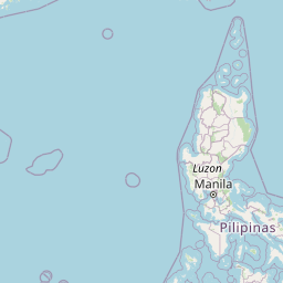


Leaflet | © OpenStreetMap contributors
Time
Current local time in Chúc Sơn:
Time: 21:43 +07
Date: 2025-03-21
Sunrise and Sunset
| Date | Sunrise | Sunset |
|---|---|---|
| 2025-03-21 (Today) | 05:59 | 18:09 |
| 2025-03-22 (Tomorrow) | 05:58 | 18:09 |
| 2025-03-23 | 05:57 | 18:10 |
| 2025-03-24 | 05:56 | 18:10 |
| 2025-03-25 | 05:55 | 18:10 |
| 2025-03-26 | 05:54 | 18:11 |
| 2025-03-27 | 05:53 | 18:11 |