
Cities close to Cam Ranh
Cities, towns and suburbs near Cam Ranh. Tô Hạp: 25 kilometers (15 miles), Bác Ái: 29 kilometers (18 miles), Nha Trang: 36 kilometers (22 miles).
| Cities / towns / suburbs around Cam Ranh | Kilometers | Miles |
|---|---|---|
| How far is Tô Hạp from Cam Ranh | 25 | 15 |
| How far is Bác Ái from Cam Ranh | 29 | 18 |
| How far is Nha Trang from Cam Ranh | 36 | 22 |
| How far is Diên Khánh from Cam Ranh | 38 | 23 |
| How far is Khánh Hải from Cam Ranh | 39 | 24 |
| How far is Phan Rang-Tháp Chàm from Cam Ranh | 44 | 27 |
| How far is Tân Sơn from Cam Ranh | 44 | 27 |
| How far is Khánh Vĩnh from Cam Ranh | 49 | 30 |
| How far is Phước Dân from Cam Ranh | 50 | 31 |
| How far is Ninh Hòa from Cam Ranh | 64 | 39 |
Closest airport to Cam Ranh
| Airport | Kilometers | Miles |
|---|---|---|
| Cam Ranh International Airport (CXR) | 10.7 | 6.7 |
| Lien Khuong Airport (DLI) | 88.4 | 54.9 |
| Tuy Hoa Airport (TBB) | 127.0 | 78.9 |
Distance from Cam Ranh to other municipalities
| Municipality | Kilometers | Miles |
|---|---|---|
| How far is Hanoi from Cam Ranh | 1 072 | 666 |
| How far is Vinh from Cam Ranh | 838 | 521 |
| How far is Rạch Giá from Cam Ranh | 493 | 306 |
| How far is Qui Nhon from Cam Ranh | 206 | 128 |
| How far is Thành Phố Nam Định from Cam Ranh | 999 | 620 |
| How far is La Gi from Cam Ranh | 206 | 128 |
| How far is Ðà Lạt from Cam Ranh | 78 | 49 |
| How far is Cần Thơ from Cam Ranh | 423 | 263 |
| How far is Biên Hòa from Cam Ranh | 277 | 172 |
| How far is Bảo Lộc from Cam Ranh | 153 | 95 |
Location
Coordinates:
Latitude: 11°55′17″N
Longitude: 109°9′32″E
Map

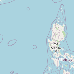


Leaflet | © OpenStreetMap contributors
Time
Current local time in Cam Ranh:
Time: 21:50 +07
Date: 2025-03-21
Sunrise and Sunset
| Date | Sunrise | Sunset |
|---|---|---|
| 2025-03-21 (Today) | 05:45 | 17:55 |
| 2025-03-22 (Tomorrow) | 05:45 | 17:55 |
| 2025-03-23 | 05:44 | 17:55 |
| 2025-03-24 | 05:43 | 17:55 |
| 2025-03-25 | 05:43 | 17:55 |
| 2025-03-26 | 05:42 | 17:55 |
| 2025-03-27 | 05:41 | 17:55 |