
Cities close to Pangai
Cities, towns and suburbs near Pangai. Neiafu: 135 kilometers (84 miles), Nuku‘alofa: 172 kilometers (107 miles), ‘Ohonua: 180 kilometers (112 miles).
| Cities / towns / suburbs around Pangai | Kilometers | Miles |
|---|---|---|
| How far is Neiafu from Pangai | 135 | 84 |
| How far is Nuku‘alofa from Pangai | 172 | 107 |
| How far is ‘Ohonua from Pangai | 180 | 112 |
| How far is Hihifo from Pangai | 433 | 269 |
Closest airport to Pangai
| Airport | Kilometers | Miles |
|---|---|---|
| Lifuka Island Airport (HPA) | 4.4 | 2.7 |
| Vavaʻu International Airport (VAV) | 142.9 | 88.8 |
| Fuaʻamotu International Airport (TBU) | 179.2 | 111.3 |
Distance from Pangai to other municipalities
| Municipality | Kilometers | Miles |
|---|---|---|
| How far is Neiafu from Pangai | 135 | 84 |
| How far is Hihifo from Pangai | 433 | 269 |
Location
Coordinates:
Latitude: 19°48′52″S
Longitude: 174°21′15″W
Map

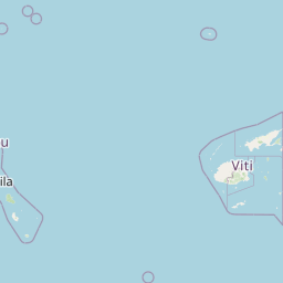


Leaflet | © OpenStreetMap contributors
Time
Current local time in Pangai:
Time: 09:50 +13
Date: 2025-02-19
Sunrise and Sunset
| Date | Sunrise | Sunset |
|---|---|---|
| 2025-02-19 (Today) | 06:30 | 19:11 |
| 2025-02-20 (Tomorrow) | 06:30 | 19:11 |
| 2025-02-21 | 06:31 | 19:10 |
| 2025-02-22 | 06:31 | 19:09 |
| 2025-02-23 | 06:32 | 19:09 |
| 2025-02-24 | 06:32 | 19:08 |
| 2025-02-25 | 06:32 | 19:07 |