
Cities close to Altea
Cities, towns and suburbs near Altea. l'Alfàs del Pi: 5 kilometers (3 miles), Callosa d'En Sarrià: 8 kilometers (5 miles), Benidorm: 10 kilometers (6 miles).
| Cities / towns / suburbs around Altea | Kilometers | Miles |
|---|---|---|
| How far is l'Alfàs del Pi from Altea | 5 | 3 |
| How far is Callosa d'En Sarrià from Altea | 8 | 5 |
| How far is Benidorm from Altea | 10 | 6 |
| How far is Bolulla from Altea | 10 | 6 |
| How far is Finestrat from Altea | 14 | 9 |
| How far is Benissa from Altea | 16 | 10 |
| How far is Parcent from Altea | 16 | 10 |
| How far is Benimantell from Altea | 16 | 10 |
| How far is Senija from Altea | 16 | 10 |
| How far is Alcalalí from Altea | 17 | 10 |
Closest airport to Altea
| Airport | Kilometers | Miles |
|---|---|---|
| Alicante–Elche Airport (ALC) | 56.5 | 35.1 |
| Valencia Airport (VLC) | 105.9 | 65.8 |
| Murcia–San Javier Airport (MJV) | 113.3 | 70.4 |
Distance from Altea to other municipalities
| Municipality | Kilometers | Miles |
|---|---|---|
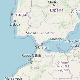
| How far is Sevilla from Altea | 536 | 333 |
| How far is Palma from Altea | 257 | 160 |
| How far is Granada from Altea | 349 | 217 |
| How far is Elche from Altea | 68 | 42 |
| How far is Córdoba from Altea | 420 | 261 |
| How far is Gasteiz / Vitoria from Altea | 522 | 324 |
| How far is Madrid from Altea | 373 | 232 |
| How far is Castro-Urdiales from Altea | 595 | 369 |
| How far is Barcelona from Altea | 363 | 225 |
Location
Coordinates:
Latitude: 38°35′55″N
Longitude: 0°3′5″W
Map


Leaflet | © OpenStreetMap contributors
Time
Current local time in Altea:
Time: 13:55 CET
Date: 2025-03-21
Sunrise and Sunset
| Date | Sunrise | Sunset |
|---|---|---|
| 2025-03-21 (Today) | 07:00 | 19:14 |
| 2025-03-22 (Tomorrow) | 06:58 | 19:15 |
| 2025-03-23 | 06:57 | 19:16 |
| 2025-03-24 | 06:55 | 19:17 |
| 2025-03-25 | 06:53 | 19:18 |
| 2025-03-26 | 06:52 | 19:19 |
| 2025-03-27 | 06:50 | 19:20 |