
Cities close to Lukhovitsy
Cities, towns and suburbs near Lukhovitsy. Ramenskoye: 83 kilometers (52 miles), Orekhovo-Borisovo Yuzhnoye: 111 kilometers (69 miles), Cherëmushki: 121 kilometers (75 miles).
| Cities / towns / suburbs around Lukhovitsy | Kilometers | Miles |
|---|---|---|
| How far is Ramenskoye from Lukhovitsy | 83 | 52 |
| How far is Orekhovo-Borisovo Yuzhnoye from Lukhovitsy | 111 | 69 |
| How far is Cherëmushki from Lukhovitsy | 121 | 75 |
| How far is Krasnaya Pahra from Lukhovitsy | 123 | 77 |
| How far is LMS from Lukhovitsy | 124 | 77 |
| How far is Moscow from Lukhovitsy | 125 | 78 |
| How far is Tula from Lukhovitsy | 126 | 79 |
| How far is Vostochnoe Degunino from Lukhovitsy | 137 | 85 |
| How far is Vladimir from Lukhovitsy | 154 | 96 |
| How far is Kaluga from Lukhovitsy | 185 | 115 |
Closest airport to Lukhovitsy
| Airport | Kilometers | Miles |
|---|---|---|
| Zhukovsky International Airport (ZIA) | 85.7 | 53.2 |
| Moscow Domodedovo Airport (DME) | 86.9 | 54.0 |
| Moscow Ostafyevo International Airport (OSF) | 114.3 | 71.0 |
Location
Coordinates:
Latitude: 54°58′35″N
Longitude: 39°2′39″E
Map
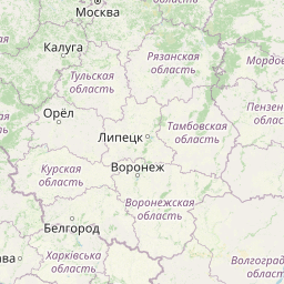


Leaflet | © OpenStreetMap contributors
Time
Current local time in Lukhovitsy:
Time: 02:50 MSK
Date: 2025-02-18
Sunrise and Sunset
| Date | Sunrise | Sunset |
|---|---|---|
| 2025-02-18 (Today) | 07:36 | 17:38 |
| 2025-02-19 (Tomorrow) | 07:34 | 17:40 |
| 2025-02-20 | 07:32 | 17:42 |
| 2025-02-21 | 07:30 | 17:44 |
| 2025-02-22 | 07:27 | 17:46 |
| 2025-02-23 | 07:25 | 17:48 |
| 2025-02-24 | 07:23 | 17:50 |