
Cities close to Lucena
Cities, towns and suburbs near Lucena. Candelaria: 21 kilometers (13 miles), Padre Burgos: 21 kilometers (13 miles), San Juan: 26 kilometers (16 miles).
| Cities / towns / suburbs around Lucena | Kilometers | Miles |
|---|---|---|
| How far is Candelaria from Lucena | 21 | 13 |
| How far is Padre Burgos from Lucena | 21 | 13 |
| How far is San Juan from Lucena | 26 | 16 |
| How far is Majayjay from Lucena | 29 | 18 |
| How far is Santa Cruz from Lucena | 30 | 18 |
| How far is Luisiana from Lucena | 30 | 19 |
| How far is Rizal from Lucena | 31 | 19 |
| How far is Nagcarlan from Lucena | 31 | 20 |
| How far is Tiaong from Lucena | 32 | 20 |
| How far is Agdangan from Lucena | 32 | 20 |
Closest airport to Lucena
| Airport | Kilometers | Miles |
|---|---|---|
| Ninoy Aquino International Airport (MNL) | 91.0 | 56.5 |
| Subic Bay International Airport (SFS) | 174.1 | 108.2 |
| Clark International Airport (CRK) | 180.2 | 112.0 |
Distance from Lucena to other municipalities
| Municipality | Kilometers | Miles |
|---|---|---|
| How far is Talavera from Lucena | 199 | 124 |
| How far is Rodriguez from Lucena | 103 | 64 |
| How far is Carmona from Lucena | 74 | 46 |
| How far is Tarlac City from Lucena | 204 | 127 |
| How far is Roxas City from Lucena | 288 | 179 |
| How far is Baguio from Lucena | 297 | 185 |
| How far is Angeles City from Lucena | 175 | 109 |
| How far is Vigan from Lucena | 426 | 265 |
| How far is Paniqui from Lucena | 223 | 139 |
| How far is Naga from Lucena | 172 | 107 |
Location
Coordinates:
Latitude: 13°55′53″N
Longitude: 121°37′1″E
Map
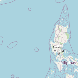


Leaflet | © OpenStreetMap contributors
Time
Current local time in Lucena:
Time: 22:50 PST
Date: 2025-03-22
Sunrise and Sunset
| Date | Sunrise | Sunset |
|---|---|---|
| 2025-03-22 (Today) | 05:55 | 18:05 |
| 2025-03-23 (Tomorrow) | 05:54 | 18:05 |
| 2025-03-24 | 05:53 | 18:05 |
| 2025-03-25 | 05:53 | 18:05 |
| 2025-03-26 | 05:52 | 18:06 |
| 2025-03-27 | 05:51 | 18:06 |
| 2025-03-28 | 05:51 | 18:06 |