
Cities close to Celendín
Cities, towns and suburbs near Celendín. Huacapampa: 8 kilometers (5 miles), Lucmapampa: 11 kilometers (7 miles), Utco: 12 kilometers (7 miles).
| Cities / towns / suburbs around Celendín | Kilometers | Miles |
|---|---|---|
| How far is Huacapampa from Celendín | 8 | 5 |
| How far is Lucmapampa from Celendín | 11 | 7 |
| How far is Utco from Celendín | 12 | 7 |
| How far is Sorochuco from Celendín | 13 | 8 |
| How far is Balsas from Celendín | 15 | 9 |
| How far is Oxamarca from Celendín | 21 | 13 |
| How far is Chumuch from Celendín | 31 | 19 |
| How far is Cocabamba from Celendín | 33 | 20 |
| How far is Encañada from Celendín | 33 | 21 |
| How far is Chuquibamba from Celendín | 33 | 21 |
Closest airport to Celendín
| Airport | Kilometers | Miles |
|---|---|---|
| Mayor General FAP Armando Revoredo Iglesias Airport (CJA) | 48.6 | 30.2 |
| Shumba Airport (JAE) | 157.9 | 98.1 |
| Capitán FAP Carlos Martínez de Pinillos International Airport (TRU) | 172.1 | 106.9 |
Distance from Celendín to other municipalities
| Municipality | Kilometers | Miles |
|---|---|---|
| How far is Chiclayo from Celendín | 187 | 116 |
| How far is Huancayo from Celendín | 662 | 411 |
Location
Coordinates:
Latitude: 6°51′57″S
Longitude: 78°8′45″W
Map
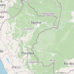


Leaflet | © OpenStreetMap contributors
Time
Current local time in Celendín:
Time: 08:38 -05
Date: 2025-03-21
Sunrise and Sunset
| Date | Sunrise | Sunset |
|---|---|---|
| 2025-03-21 (Today) | 06:15 | 18:23 |
| 2025-03-22 (Tomorrow) | 06:15 | 18:23 |
| 2025-03-23 | 06:15 | 18:22 |
| 2025-03-24 | 06:15 | 18:22 |
| 2025-03-25 | 06:14 | 18:21 |
| 2025-03-26 | 06:14 | 18:21 |
| 2025-03-27 | 06:14 | 18:20 |