
Cities close to Santa Fé
Cities, towns and suburbs near Santa Fé. Cucunatí: 14 kilometers (9 miles), Agua Fría Número Uno: 23 kilometers (14 miles), Barriales: 26 kilometers (16 miles).
| Cities / towns / suburbs around Santa Fé | Kilometers | Miles |
|---|---|---|
| How far is Cucunatí from Santa Fé | 14 | 9 |
| How far is Agua Fría Número Uno from Santa Fé | 23 | 14 |
| How far is Barriales from Santa Fé | 26 | 16 |
| How far is Metetí from Santa Fé | 27 | 16 |
| How far is La Palma from Santa Fé | 28 | 17 |
| How far is Mortí from Santa Fé | 29 | 18 |
| How far is Platanilla from Santa Fé | 31 | 19 |
| How far is Tortí from Santa Fé | 40 | 25 |
| How far is Setegantí from Santa Fé | 41 | 25 |
| How far is Brujas from Santa Fé | 41 | 26 |
Closest airport to Santa Fé
| Airport | Kilometers | Miles |
|---|---|---|
| Jaqué Airport (JQE) | 126.6 | 78.7 |
| Tocumen International Airport (PTY) | 142.2 | 88.3 |
| Albrook "Marcos A. Gelabert" International Airport (PAC) | 157.4 | 97.8 |
Location
Coordinates:
Latitude: 8°39′18″N
Longitude: 78°9′41″W
Map
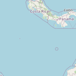


Leaflet | © OpenStreetMap contributors
Time
Current local time in Santa Fé:
Time: 09:35 EST
Date: 2025-03-21
Sunrise and Sunset
| Date | Sunrise | Sunset |
|---|---|---|
| 2025-03-21 (Today) | 06:14 | 18:24 |
| 2025-03-22 (Tomorrow) | 06:14 | 18:24 |
| 2025-03-23 | 06:13 | 18:24 |
| 2025-03-24 | 06:13 | 18:24 |
| 2025-03-25 | 06:12 | 18:24 |
| 2025-03-26 | 06:12 | 18:24 |
| 2025-03-27 | 06:11 | 18:24 |