
Cities close to Shendam
Cities, towns and suburbs near Shendam. Mabudi: 32 kilometers (20 miles), Baap: 33 kilometers (21 miles), Langtang: 41 kilometers (25 miles).
| Cities / towns / suburbs around Shendam | Kilometers | Miles |
|---|---|---|
| How far is Mabudi from Shendam | 32 | 20 |
| How far is Baap from Shendam | 33 | 21 |
| How far is Langtang from Shendam | 41 | 25 |
| How far is Pankshin from Shendam | 51 | 32 |
| How far is Wase from Shendam | 52 | 32 |
| How far is Kwal from Shendam | 56 | 35 |
| How far is Dengi from Shendam | 72 | 45 |
| How far is Bokkos from Shendam | 76 | 47 |
| How far is Ibi from Shendam | 81 | 50 |
| How far is Mangu from Shendam | 86 | 53 |
Closest airport to Shendam
| Airport | Kilometers | Miles |
|---|---|---|
| Yakubu Gowon Airport (JOS) | 111.9 | 69.5 |
| Makurdi Airport (MDI) | 165.5 | 102.8 |
| Bauchi State Airport (BCU) | 180.0 | 111.9 |
Distance from Shendam to other municipalities
| Municipality | Kilometers | Miles |
|---|---|---|
| How far is Jos from Shendam | 136 | 85 |
| How far is Lagos from Shendam | 728 | 453 |
| How far is Keffi from Shendam | 183 | 113 |
Location
Coordinates:
Latitude: 8°52′43″N
Longitude: 9°32′4″E
Map
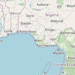

Leaflet | © OpenStreetMap contributors
Time
Current local time in Shendam:
Time: 16:21 WAT
Date: 2025-02-15
Sunrise and Sunset
| Date | Sunrise | Sunset |
|---|---|---|
| 2025-02-15 (Today) | 06:39 | 18:32 |
| 2025-02-16 (Tomorrow) | 06:39 | 18:32 |
| 2025-02-17 | 06:38 | 18:32 |
| 2025-02-18 | 06:38 | 18:33 |
| 2025-02-19 | 06:38 | 18:33 |
| 2025-02-20 | 06:37 | 18:33 |
| 2025-02-21 | 06:37 | 18:33 |