
Cities close to Irrua
Cities, towns and suburbs near Irrua. Ekpoma: 9 kilometers (5 miles), Igueben: 15 kilometers (9 miles), Ubiaja: 20 kilometers (13 miles).
| Cities / towns / suburbs around Irrua | Kilometers | Miles |
|---|---|---|
| How far is Ekpoma from Irrua | 9 | 5 |
| How far is Igueben from Irrua | 15 | 9 |
| How far is Ubiaja from Irrua | 20 | 13 |
| How far is Ehor from Irrua | 29 | 18 |
| How far is Afuze from Irrua | 32 | 20 |
| How far is Sabongida-Ora from Irrua | 37 | 23 |
| How far is Auchi from Irrua | 37 | 23 |
| How far is Fugar from Irrua | 50 | 31 |
| How far is Onyedega from Irrua | 53 | 33 |
| How far is Abudu from Irrua | 53 | 33 |
Closest airport to Irrua
| Airport | Kilometers | Miles |
|---|---|---|
| Benin Airport (BNI) | 83.0 | 51.6 |
| Akure Airport (AKR) | 116.3 | 72.3 |
| Warri Airport (QRW) | 134.5 | 83.6 |
Distance from Irrua to other municipalities
| Municipality | Kilometers | Miles |
|---|---|---|
| How far is Benin City from Irrua | 79 | 49 |
| How far is Warri from Irrua | 145 | 90 |
| How far is Oyo from Irrua | 281 | 175 |
| How far is Ondo from Irrua | 158 | 98 |
Location
Coordinates:
Latitude: 6°44′10″N
Longitude: 6°13′11″E
Map
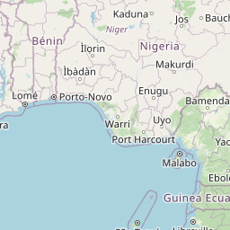

Leaflet | © OpenStreetMap contributors
Time
Current local time in Irrua:
Time: 14:54 WAT
Date: 2025-03-21
Sunrise and Sunset
| Date | Sunrise | Sunset |
|---|---|---|
| 2025-03-21 (Today) | 06:37 | 18:46 |
| 2025-03-22 (Tomorrow) | 06:37 | 18:46 |
| 2025-03-23 | 06:36 | 18:46 |
| 2025-03-24 | 06:36 | 18:46 |
| 2025-03-25 | 06:35 | 18:46 |
| 2025-03-26 | 06:35 | 18:46 |
| 2025-03-27 | 06:34 | 18:46 |