
Cities close to Goronyo
Cities, towns and suburbs near Goronyo. Wurno: 32 kilometers (20 miles), Gada: 35 kilometers (22 miles), Rabah: 40 kilometers (25 miles).
| Cities / towns / suburbs around Goronyo | Kilometers | Miles |
|---|---|---|
| How far is Wurno from Goronyo | 32 | 20 |
| How far is Gada from Goronyo | 35 | 22 |
| How far is Rabah from Goronyo | 40 | 25 |
| How far is Gwadabawa from Goronyo | 48 | 30 |
| How far is Kware from Goronyo | 50 | 31 |
| How far is Illela from Goronyo | 52 | 32 |
| How far is Sokoto from Goronyo | 63 | 39 |
| How far is Sabon Birni from Goronyo | 72 | 45 |
| How far is Dange from Goronyo | 74 | 46 |
| How far is Wamako from Goronyo | 77 | 48 |
Closest airport to Goronyo
| Airport | Kilometers | Miles |
|---|---|---|
| Sadiq Abubakar III International Airport (SKO) | 77.3 | 48.0 |
| Mallam Aminu Kano International Airport (KAN) | 346.4 | 215.3 |
| Kaduna International Airport (KAD) | 354.4 | 220.2 |
Location
Coordinates:
Latitude: 13°26′32″N
Longitude: 5°40′20″E
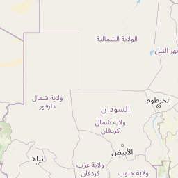
Map

Leaflet | © OpenStreetMap contributors
Time
Current local time in Goronyo:
Time: 15:27 WAT
Date: 2025-03-21
Sunrise and Sunset
| Date | Sunrise | Sunset |
|---|---|---|
| 2025-03-21 (Today) | 06:39 | 18:49 |
| 2025-03-22 (Tomorrow) | 06:38 | 18:49 |
| 2025-03-23 | 06:38 | 18:49 |
| 2025-03-24 | 06:37 | 18:49 |
| 2025-03-25 | 06:36 | 18:49 |
| 2025-03-26 | 06:36 | 18:49 |
| 2025-03-27 | 06:35 | 18:49 |