
Cities close to Boh
Cities, towns and suburbs near Boh. Kaltungo: 5 kilometers (3 miles), Billiri: 14 kilometers (9 miles), Kumo: 31 kilometers (19 miles).
| Cities / towns / suburbs around Boh | Kilometers | Miles |
|---|---|---|
| How far is Kaltungo from Boh | 5 | 3 |
| How far is Billiri from Boh | 14 | 9 |
| How far is Kumo from Boh | 31 | 19 |
| How far is Talasse from Boh | 49 | 30 |
| How far is Deba from Boh | 49 | 31 |
| How far is Karim Lamido from Boh | 53 | 33 |
| How far is Gombe from Boh | 58 | 36 |
| How far is Lamurde from Boh | 60 | 37 |
| How far is Lau from Boh | 64 | 40 |
| How far is Guyuk from Boh | 72 | 45 |
Closest airport to Boh
| Airport | Kilometers | Miles |
|---|---|---|
| Gombe Lawanti International Airport (GMO) | 71.2 | 44.2 |
| Yola Airport (YOL) | 139.3 | 86.5 |
| Bauchi State Airport (BCU) | 185.4 | 115.2 |
Location
Coordinates:
Latitude: 9°46′54″N
Longitude: 11°16′43″E
Map
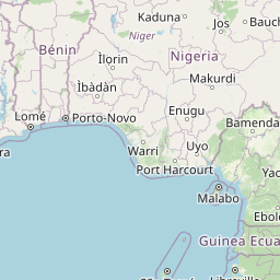
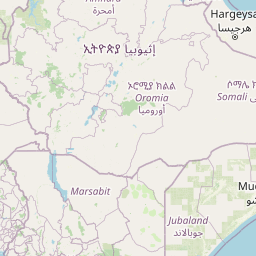

Leaflet | © OpenStreetMap contributors
Time
Current local time in Boh:
Time: 13:54 WAT
Date: 2025-03-21
Sunrise and Sunset
| Date | Sunrise | Sunset |
|---|---|---|
| 2025-03-21 (Today) | 06:17 | 18:26 |
| 2025-03-22 (Tomorrow) | 06:16 | 18:26 |
| 2025-03-23 | 06:16 | 18:26 |
| 2025-03-24 | 06:15 | 18:26 |
| 2025-03-25 | 06:14 | 18:26 |
| 2025-03-26 | 06:14 | 18:26 |
| 2025-03-27 | 06:13 | 18:26 |