
Cities close to Larache
Cities, towns and suburbs near Larache. Arbaoua: 37 kilometers (23 miles), Lalla Mimouna: 39 kilometers (25 miles), Dar Chaoui: 55 kilometers (34 miles).
| Cities / towns / suburbs around Larache | Kilometers | Miles |
|---|---|---|
| How far is Arbaoua from Larache | 37 | 23 |
| How far is Lalla Mimouna from Larache | 39 | 25 |
| How far is Dar Chaoui from Larache | 55 | 34 |
| How far is Souq Larb’a al Gharb from Larache | 58 | 36 |
| How far is Brikcha from Larache | 59 | 36 |
| How far is Boukhalef from Larache | 64 | 40 |
| How far is Ouezzane from Larache | 69 | 43 |
| How far is Mechraa Bel Ksiri from Larache | 71 | 44 |
| How far is Tangier from Larache | 72 | 44 |
| How far is Zinat from Larache | 73 | 46 |
Closest airport to Larache
| Airport | Kilometers | Miles |
|---|---|---|
| Tangier Ibn Battouta Airport (TNG) | 63.2 | 39.3 |
| Gibraltar International Airport (GIB) | 129.2 | 80.3 |
| Rabat–Salé Airport (RBA) | 138.3 | 85.9 |
Distance from Larache to other municipalities
| Municipality | Kilometers | Miles |
|---|---|---|
| How far is Rabat from Larache | 145 | 90 |
| How far is Guelmim from Larache | 782 | 486 |
| How far is Khemisset from Larache | 152 | 95 |
| How far is Agadir from Larache | 621 | 386 |
Location
Coordinates:
Latitude: 35°11′35″N
Longitude: 6°9′20″W
Map

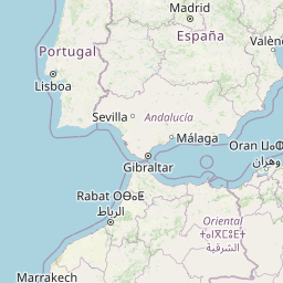


Leaflet | © OpenStreetMap contributors
Time
Current local time in Larache:
Time: 09:59 +00
Date: 2025-03-20
Sunrise and Sunset
| Date | Sunrise | Sunset |
|---|---|---|
| 2025-03-20 (Today) | 06:26 | 18:37 |
| 2025-03-21 (Tomorrow) | 06:25 | 18:38 |
| 2025-03-22 | 06:23 | 18:39 |
| 2025-03-23 | 06:22 | 18:40 |
| 2025-03-24 | 06:20 | 18:40 |
| 2025-03-25 | 06:19 | 18:41 |
| 2025-03-26 | 06:17 | 18:42 |