
Cities close to Bornuur
Cities, towns and suburbs near Bornuur. Ihsüüj: 27 kilometers (17 miles), Jargalant: 30 kilometers (19 miles), Mandal: 37 kilometers (23 miles).
| Cities / towns / suburbs around Bornuur | Kilometers | Miles |
|---|---|---|
| How far is Ihsüüj from Bornuur | 27 | 17 |
| How far is Jargalant from Bornuur | 30 | 19 |
| How far is Mandal from Bornuur | 37 | 23 |
| How far is Dzüünkharaa from Bornuur | 39 | 24 |
| How far is Javhlant from Bornuur | 45 | 28 |
| How far is Dund-Urt from Bornuur | 54 | 34 |
| How far is Argalant from Bornuur | 64 | 40 |
| How far is Ar-Asgat from Bornuur | 67 | 42 |
| How far is Orgil from Bornuur | 70 | 43 |
| How far is Ulan Bator from Bornuur | 77 | 48 |
Closest airport to Bornuur
| Airport | Kilometers | Miles |
|---|---|---|
| Buyant-Ukhaa International Airport (ULN) | 78.7 | 48.9 |
| Chinggis Khaan International Airport (UBN) | 100.1 | 62.2 |
| Bulgan Airport (UGA) | 209.7 | 130.3 |
Location
Coordinates:
Latitude: 48°28′0″N
Longitude: 106°16′0″E
Map
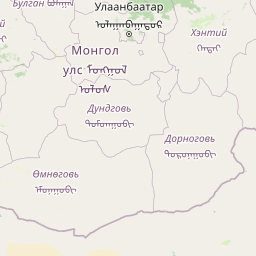

Leaflet | © OpenStreetMap contributors
Time
Current local time in Bornuur:
Time: 12:40 +08
Date: 2025-03-02
Sunrise and Sunset
| Date | Sunrise | Sunset |
|---|---|---|
| 2025-03-02 (Today) | 07:32 | 18:41 |
| 2025-03-03 (Tomorrow) | 07:30 | 18:42 |
| 2025-03-04 | 07:28 | 18:44 |
| 2025-03-05 | 07:26 | 18:46 |
| 2025-03-06 | 07:24 | 18:47 |
| 2025-03-07 | 07:22 | 18:49 |
| 2025-03-08 | 07:20 | 18:50 |