
Cities close to San José Chiltepec
Cities, towns and suburbs near San José Chiltepec. Valle Nacional: 24 kilometers (15 miles), San Felipe Usila: 38 kilometers (24 miles), Playa Vicente: 40 kilometers (25 miles).
Closest airport to San José Chiltepec
| Airport | Kilometers | Miles |
|---|---|---|
| Oaxaca International Airport (OAX) | 120.9 | 75.1 |
| Veracruz International Airport (VER) | 133.4 | 82.9 |
| Minatitlán/Coatzacoalcos International Airport (MTT) | 169.1 | 105.1 |
Location
Coordinates:
Latitude: 17°56′50″N
Longitude: 96°10′10″W
Map
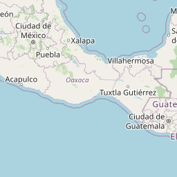


Leaflet | © OpenStreetMap contributors
Time
Current local time in San José Chiltepec:
Time: 14:44 CST
Date: 2025-02-18
Sunrise and Sunset
| Date | Sunrise | Sunset |
|---|---|---|
| 2025-02-18 (Today) | 06:48 | 18:28 |
| 2025-02-19 (Tomorrow) | 06:48 | 18:28 |
| 2025-02-20 | 06:47 | 18:29 |
| 2025-02-21 | 06:46 | 18:29 |
| 2025-02-22 | 06:46 | 18:29 |
| 2025-02-23 | 06:45 | 18:30 |
| 2025-02-24 | 06:45 | 18:30 |