
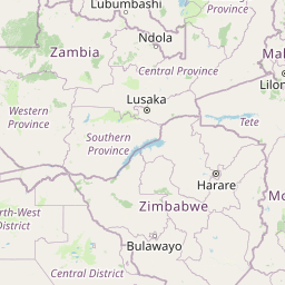
Cities close to Salima
Cities, towns and suburbs near Salima. Dowa: 58 kilometers (36 miles), Ntchisi: 65 kilometers (40 miles), Dedza: 68 kilometers (42 miles).
| Cities / towns / suburbs around Salima | Kilometers | Miles |
|---|---|---|
| How far is Dowa from Salima | 58 | 36 |
| How far is Ntchisi from Salima | 65 | 40 |
| How far is Dedza from Salima | 68 | 42 |
| How far is Lilongwe from Salima | 75 | 47 |
| How far is Nkhotakota from Salima | 96 | 60 |
| How far is Mangochi from Salima | 116 | 72 |
| How far is Ntcheu from Salima | 117 | 73 |
| How far is Kasungu from Salima | 134 | 83 |
| How far is Balaka from Salima | 144 | 89 |
| How far is Mchinji from Salima | 170 | 106 |
Closest airport to Salima
| Airport | Kilometers | Miles |
|---|---|---|
| Lilongwe International Airport (LLW) | 73.3 | 45.5 |
| Club Makokola Airport (CMK) | 93.4 | 58.1 |
| Lichinga Airport (VXC) | 104.0 | 64.6 |
Distance from Salima to other municipalities
| Municipality | Kilometers | Miles |
|---|---|---|
| How far is Mangochi from Salima | 116 | 72 |
| How far is Nkhotakota from Salima | 96 | 60 |
| How far is Blantyre from Salima | 231 | 143 |
| How far is Zomba from Salima | 201 | 125 |
| How far is Balaka from Salima | 144 | 89 |
| How far is Liwonde from Salima | 165 | 103 |
| How far is Mzuzu from Salima | 262 | 163 |
| How far is Nkhata Bay from Salima | 242 | 151 |
| How far is Ntcheu from Salima | 117 | 73 |
| How far is Mzimba from Salima | 229 | 142 |
Location
Coordinates:
Latitude: 13°46′49″S
Longitude: 34°27′31″E
Map
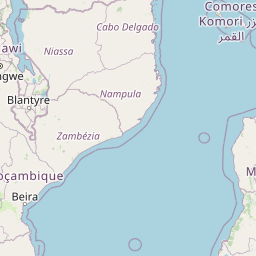


Leaflet | © OpenStreetMap contributors
Time
Current local time in Salima:
Time: 08:29 CAT
Date: 2025-02-24
Sunrise and Sunset
| Date | Sunrise | Sunset |
|---|---|---|
| 2025-02-24 (Today) | 05:41 | 18:09 |
| 2025-02-25 (Tomorrow) | 05:41 | 18:08 |
| 2025-02-26 | 05:41 | 18:08 |
| 2025-02-27 | 05:42 | 18:07 |
| 2025-02-28 | 05:42 | 18:06 |
| 2025-03-01 | 05:42 | 18:06 |
| 2025-03-02 | 05:42 | 18:05 |