
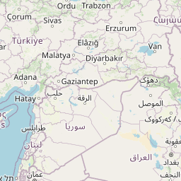
Cities close to Kelar
Cities, towns and suburbs near Kelar. Khānaqīn: 32 kilometers (20 miles), Kifrī: 33 kilometers (21 miles), Derbendîxan: 63 kilometers (39 miles).
| Cities / towns / suburbs around Kelar | Kilometers | Miles |
|---|---|---|
| How far is Khānaqīn from Kelar | 32 | 20 |
| How far is Kifrī from Kelar | 33 | 21 |
| How far is Derbendîxan from Kelar | 63 | 39 |
| How far is Tozkhurmato from Kelar | 69 | 43 |
| How far is Qeredagh from Kelar | 76 | 47 |
| How far is Al Miqdādīyah from Kelar | 80 | 50 |
| How far is Ḩalabjah al Jadīdah from Kelar | 84 | 52 |
| How far is Seyid Sadiq from Kelar | 95 | 59 |
| How far is Dāqūq from Kelar | 98 | 61 |
| How far is As Sulaymānīyah from Kelar | 105 | 65 |
Closest airport to Kelar
| Airport | Kilometers | Miles |
|---|---|---|
| Sulaimaniyah International Airport (ISU) | 103.9 | 64.6 |
| Sanandaj Airport (SDG) | 168.9 | 105.0 |
| Kermanshah Airport (KSH) | 171.7 | 106.7 |
Location
Coordinates:
Latitude: 34°37′40″N
Longitude: 45°19′6″E
Map
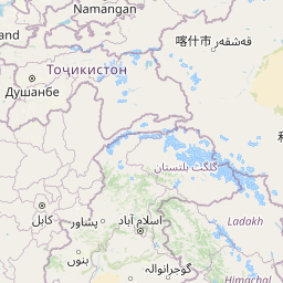

Leaflet | © OpenStreetMap contributors
Time
Current local time in Kelar:
Time: 12:19 +03
Date: 2025-03-20
Sunrise and Sunset
| Date | Sunrise | Sunset |
|---|---|---|
| 2025-03-20 (Today) | 06:00 | 18:11 |
| 2025-03-21 (Tomorrow) | 05:59 | 18:12 |
| 2025-03-22 | 05:58 | 18:13 |
| 2025-03-23 | 05:56 | 18:13 |
| 2025-03-24 | 05:55 | 18:14 |
| 2025-03-25 | 05:53 | 18:15 |
| 2025-03-26 | 05:52 | 18:16 |