
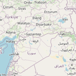
Cities close to Badrah
Cities, towns and suburbs near Badrah. Al Kūt: 68 kilometers (42 miles), An Nu‘mānīyah: 79 kilometers (49 miles), Al ‘Azīzīyah: 84 kilometers (52 miles).
| Cities / towns / suburbs around Badrah | Kilometers | Miles |
|---|---|---|
| How far is Al Kūt from Badrah | 68 | 42 |
| How far is An Nu‘mānīyah from Badrah | 79 | 49 |
| How far is Al ‘Azīzīyah from Badrah | 84 | 52 |
| How far is ‘Alī al Gharbī from Badrah | 101 | 63 |
| How far is Baladrūz from Badrah | 102 | 64 |
| How far is Al Ḩayy from Badrah | 105 | 65 |
| How far is Aş Şuwayrah from Badrah | 110 | 68 |
| How far is Al Miqdādīyah from Badrah | 133 | 83 |
| How far is ‘Afak from Badrah | 133 | 83 |
| How far is Nāḩiyat Alī ash Sharqī from Badrah | 134 | 83 |
Closest airport to Badrah
| Airport | Kilometers | Miles |
|---|---|---|
| Baghdad International Airport (BGW) | 159.1 | 98.9 |
| Kermanshah Airport (KSH) | 177.8 | 110.5 |
| Al Najaf International Airport (NJF) | 190.5 | 118.3 |
Location
Coordinates:
Latitude: 33°6′54″N
Longitude: 45°56′0″E
Map
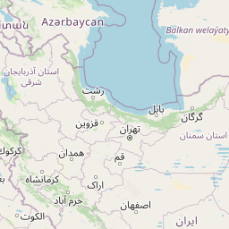
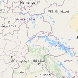

Leaflet | © OpenStreetMap contributors
Time
Current local time in Badrah:
Time: 16:03 +03
Date: 2025-03-21
Sunrise and Sunset
| Date | Sunrise | Sunset |
|---|---|---|
| 2025-03-21 (Today) | 05:57 | 18:09 |
| 2025-03-22 (Tomorrow) | 05:55 | 18:10 |
| 2025-03-23 | 05:54 | 18:11 |
| 2025-03-24 | 05:53 | 18:11 |
| 2025-03-25 | 05:51 | 18:12 |
| 2025-03-26 | 05:50 | 18:13 |
| 2025-03-27 | 05:49 | 18:14 |