
Cities close to Pagat
Cities, towns and suburbs near Pagat. Birayang: 10 kilometers (6 miles), Pantaihambawang: 12 kilometers (7 miles), Loklaga: 12 kilometers (7 miles).
| Cities / towns / suburbs around Pagat | Kilometers | Miles |
|---|---|---|
| How far is Birayang from Pagat | 10 | 6 |
| How far is Pantaihambawang from Pagat | 12 | 7 |
| How far is Loklaga from Pagat | 12 | 7 |
| How far is Haruyan from Pagat | 12 | 7 |
| How far is Alung from Pagat | 12 | 7 |
| How far is Barikin from Pagat | 14 | 8 |
| How far is Kasarangan from Pagat | 15 | 9 |
| How far is Angkimang from Pagat | 18 | 11 |
| How far is Batumandi from Pagat | 23 | 14 |
| How far is Telagalangsat from Pagat | 24 | 15 |
Closest airport to Pagat
| Airport | Kilometers | Miles |
|---|---|---|
| Warukin Airport (TJG) | 45.4 | 28.2 |
| Gusti Syamsir Alam Airport (KBU) | 110.4 | 68.6 |
| Syamsudin Noor International Airport (BDJ) | 117.7 | 73.1 |
Location
Coordinates:
Latitude: 2°37′27″S
Longitude: 115°26′1″E
Map
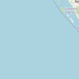


Leaflet | © OpenStreetMap contributors
Time
Current local time in Pagat:
Time: 17:59 WITA
Date: 2025-03-20
Sunrise and Sunset
| Date | Sunrise | Sunset |
|---|---|---|
| 2025-03-20 (Today) | 06:21 | 18:30 |
| 2025-03-21 (Tomorrow) | 06:21 | 18:29 |
| 2025-03-22 | 06:20 | 18:29 |
| 2025-03-23 | 06:20 | 18:29 |
| 2025-03-24 | 06:20 | 18:28 |
| 2025-03-25 | 06:20 | 18:28 |
| 2025-03-26 | 06:19 | 18:27 |