
Cities close to Shāhāda
Cities, towns and suburbs near Shāhāda. Valsād: 190 kilometers (118 miles), Aurangabad: 206 kilometers (128 miles), Silvassa: 208 kilometers (130 miles).
| Cities / towns / suburbs around Shāhāda | Kilometers | Miles |
|---|---|---|
| How far is Valsād from Shāhāda | 190 | 118 |
| How far is Aurangabad from Shāhāda | 206 | 128 |
| How far is Silvassa from Shāhāda | 208 | 130 |
| How far is Daman from Shāhāda | 212 | 131 |
| How far is Ghandinagar from Shāhāda | 261 | 162 |
| How far is Beed from Shāhāda | 314 | 195 |
| How far is Mumbai from Shāhāda | 321 | 199 |
| How far is Neemuch from Shāhāda | 328 | 204 |
| How far is Amrāvati from Shāhāda | 347 | 215 |
| How far is Bhopal from Shāhāda | 356 | 221 |
Closest airport to Shāhāda
| Airport | Kilometers | Miles |
|---|---|---|
| Vadodara Airport (BDQ) | 155.8 | 96.8 |
| Nashik Airport (ISK) | 169.1 | 105.0 |
| Surat Airport (STV) | 185.6 | 115.3 |
Location
Coordinates:
Latitude: 21°32′43″N
Longitude: 74°28′15″E
Map
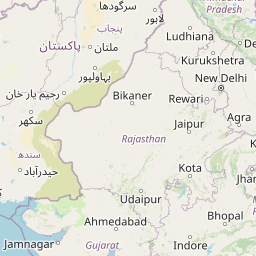


Leaflet | © OpenStreetMap contributors
Time
Current local time in Shāhāda:
Time: 19:16 IST
Date: 2025-03-21
Sunrise and Sunset
| Date | Sunrise | Sunset |
|---|---|---|
| 2025-03-21 (Today) | 06:33 | 18:44 |
| 2025-03-22 (Tomorrow) | 06:33 | 18:44 |
| 2025-03-23 | 06:32 | 18:45 |
| 2025-03-24 | 06:31 | 18:45 |
| 2025-03-25 | 06:30 | 18:45 |
| 2025-03-26 | 06:29 | 18:46 |
| 2025-03-27 | 06:28 | 18:46 |