
Cities close to Keshod
Cities, towns and suburbs near Keshod. Valsād: 289 kilometers (180 miles), Silvassa: 308 kilometers (191 miles), Ghandinagar: 329 kilometers (204 miles).
| Cities / towns / suburbs around Keshod | Kilometers | Miles |
|---|---|---|
| How far is Valsād from Keshod | 289 | 180 |
| How far is Silvassa from Keshod | 308 | 191 |
| How far is Ghandinagar from Keshod | 329 | 204 |
| How far is Mumbai from Keshod | 370 | 230 |
| How far is Nashik from Keshod | 396 | 246 |
| How far is Aurangabad from Keshod | 553 | 344 |
| How far is Ratnagiri from Keshod | 577 | 359 |
| How far is Neemuch from Keshod | 590 | 366 |
| How far is Beed from Keshod | 630 | 391 |
| How far is Osmanabad from Keshod | 698 | 434 |
Closest airport to Keshod
| Airport | Kilometers | Miles |
|---|---|---|
| Porbandar Airport (PBD) | 72.3 | 44.9 |
| Diu Airport (DIU) | 95.9 | 59.6 |
| Rajkot Airport (RAJ) | 124.7 | 77.5 |
Location
Coordinates:
Latitude: 21°18′11″N
Longitude: 70°14′54″E
Map


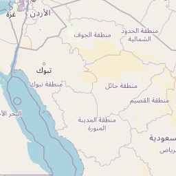


Leaflet | © OpenStreetMap contributors
Time
Current local time in Keshod:
Time: 15:31 IST
Date: 2025-02-20
Sunrise and Sunset
| Date | Sunrise | Sunset |
|---|---|---|
| 2025-02-20 (Today) | 07:14 | 18:50 |
| 2025-02-21 (Tomorrow) | 07:14 | 18:50 |
| 2025-02-22 | 07:13 | 18:51 |
| 2025-02-23 | 07:12 | 18:51 |
| 2025-02-24 | 07:12 | 18:52 |
| 2025-02-25 | 07:11 | 18:52 |
| 2025-02-26 | 07:10 | 18:53 |