
Cities close to Darbhanga
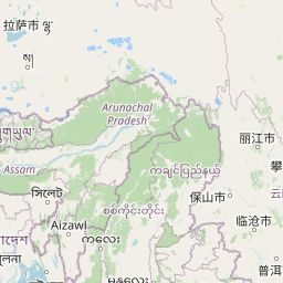
Cities, towns and suburbs near Darbhanga. Jalpāiguri: 286 kilometers (177 miles), Gangtok: 300 kilometers (186 miles), Ranchi: 318 kilometers (198 miles).
| Cities / towns / suburbs around Darbhanga | Kilometers | Miles |
|---|---|---|
| How far is Jalpāiguri from Darbhanga | 286 | 177 |
| How far is Gangtok from Darbhanga | 300 | 186 |
| How far is Ranchi from Darbhanga | 318 | 198 |
| How far is Kolkata from Darbhanga | 471 | 293 |
| How far is Lucknow from Darbhanga | 501 | 311 |
| How far is Mushalpur from Darbhanga | 553 | 344 |
| How far is Dispur from Darbhanga | 589 | 366 |
| How far is Agartala from Darbhanga | 600 | 373 |
| How far is Shillong from Darbhanga | 602 | 374 |
| How far is Morigaon from Darbhanga | 644 | 400 |
Closest airport to Darbhanga
| Airport | Kilometers | Miles |
|---|---|---|
| Janakpur Airport (JKR) | 62.0 | 38.5 |
| Jay Prakash Narayan Airport (PAT) | 102.3 | 63.6 |
| Biratnagar Airport (BIR) | 141.2 | 87.8 |
Location
Coordinates:
Latitude: 26°9′7″N
Longitude: 85°53′49″E
Map


Leaflet | © OpenStreetMap contributors
Time
Current local time in Darbhanga:
Time: 19:56 IST
Date: 2025-02-19
Sunrise and Sunset
| Date | Sunrise | Sunset |
|---|---|---|
| 2025-02-19 (Today) | 06:17 | 17:42 |
| 2025-02-20 (Tomorrow) | 06:16 | 17:43 |
| 2025-02-21 | 06:15 | 17:44 |
| 2025-02-22 | 06:14 | 17:44 |
| 2025-02-23 | 06:14 | 17:45 |
| 2025-02-24 | 06:13 | 17:46 |
| 2025-02-25 | 06:12 | 17:46 |