
Cities close to Bolgatanga
Cities, towns and suburbs near Bolgatanga. Tamale: 154 kilometers (96 miles), Wa: 198 kilometers (123 miles), Sunyani: 416 kilometers (258 miles).
| Cities / towns / suburbs around Bolgatanga | Kilometers | Miles |
|---|---|---|
| How far is Tamale from Bolgatanga | 154 | 96 |
| How far is Wa from Bolgatanga | 198 | 123 |
| How far is Sunyani from Bolgatanga | 416 | 258 |
| How far is Mamponteng from Bolgatanga | 457 | 284 |
| How far is Kumasi from Bolgatanga | 463 | 288 |
| How far is Odumase Krobo from Bolgatanga | 473 | 294 |
| How far is Ho from Bolgatanga | 487 | 303 |
| How far is Koforidua from Bolgatanga | 526 | 327 |
| How far is Wassa-Akropong from Bolgatanga | 572 | 355 |
| How far is Accra from Bolgatanga | 586 | 364 |
Closest airport to Bolgatanga
| Airport | Kilometers | Miles |
|---|---|---|
| Tamale Airport (TML) | 136.7 | 85.0 |
| Ouagadougou Airport (OUA) | 188.8 | 117.3 |
| Bobo Dioulasso Airport (BOY) | 382.5 | 237.7 |
Distance from Bolgatanga to other municipalities
| Municipality | Kilometers | Miles |
|---|---|---|
| How far is Wa from Bolgatanga | 198 | 123 |
| How far is Bawku from Bolgatanga | 73 | 46 |
| How far is Tamale from Bolgatanga | 154 | 96 |
| How far is Kumasi from Bolgatanga | 463 | 288 |
| How far is Techiman from Bolgatanga | 375 | 233 |
| How far is Sunyani from Bolgatanga | 416 | 258 |
| How far is Nkawkaw from Bolgatanga | 471 | 293 |
| How far is Sekondi-Takoradi from Bolgatanga | 658 | 409 |
| How far is Obuase from Bolgatanga | 517 | 322 |
| How far is Ho from Bolgatanga | 487 | 303 |
Location
Coordinates:
Latitude: 10°47′8″N
Longitude: 0°51′5″W
Map
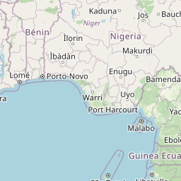


Leaflet | © OpenStreetMap contributors
Time
Current local time in Bolgatanga:
Time: 05:40 GMT
Date: 2025-02-23
Sunrise and Sunset
| Date | Sunrise | Sunset |
|---|---|---|
| 2025-02-23 (Today) | 06:19 | 18:13 |
| 2025-02-24 (Tomorrow) | 06:19 | 18:13 |
| 2025-02-25 | 06:18 | 18:14 |
| 2025-02-26 | 06:18 | 18:14 |
| 2025-02-27 | 06:17 | 18:14 |
| 2025-02-28 | 06:17 | 18:14 |
| 2025-03-01 | 06:16 | 18:14 |