
Cities close to Mbandaka
Cities, towns and suburbs near Mbandaka. Inongo: 220 kilometers (137 miles), Boende: 294 kilometers (182 miles), Gbadolite: 560 kilometers (348 miles).
| Cities / towns / suburbs around Mbandaka | Kilometers | Miles |
|---|---|---|
| How far is Inongo from Mbandaka | 220 | 137 |
| How far is Boende from Mbandaka | 294 | 182 |
| How far is Gbadolite from Mbandaka | 560 | 348 |
| How far is Kinshasa from Mbandaka | 586 | 364 |
| How far is Luebo from Mbandaka | 696 | 432 |
| How far is Tshikapa from Mbandaka | 772 | 480 |
| How far is Kisangani from Mbandaka | 772 | 480 |
| How far is Buta from Mbandaka | 781 | 485 |
| How far is Lusambo from Mbandaka | 802 | 498 |
| How far is Kananga from Mbandaka | 806 | 501 |
Closest airport to Mbandaka
| Airport | Kilometers | Miles |
|---|---|---|
| Mbandaka Airport (MDK) | 4.3 | 2.7 |
| Basango Mboliasa Airport (KRZ) | 185.7 | 115.4 |
| Basankusu Airport (BSU) | 214.7 | 133.4 |
Distance from Mbandaka to other municipalities
| Municipality | Kilometers | Miles |
|---|---|---|
| How far is Tshikapa from Mbandaka | 772 | 480 |
| How far is Mwene-Ditu from Mbandaka | 973 | 605 |
| How far is Kisangani from Mbandaka | 772 | 480 |
| How far is Kananga from Mbandaka | 806 | 501 |
| How far is Kabinda from Mbandaka | 975 | 606 |
| How far is Butembo from Mbandaka | 1 227 | 762 |
Location
Coordinates:
Latitude: 0°2′55″N
Longitude: 18°15′37″E
Map
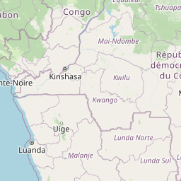


Leaflet | © OpenStreetMap contributors
Time
Current local time in Mbandaka:
Time: 00:00 WAT
Date: 2025-02-19
Sunrise and Sunset
| Date | Sunrise | Sunset |
|---|---|---|
| 2025-02-19 (Today) | 05:56 | 18:05 |
| 2025-02-20 (Tomorrow) | 05:56 | 18:05 |
| 2025-02-21 | 05:56 | 18:04 |
| 2025-02-22 | 05:55 | 18:04 |
| 2025-02-23 | 05:55 | 18:04 |
| 2025-02-24 | 05:55 | 18:04 |
| 2025-02-25 | 05:55 | 18:04 |