
Cities close to San Borja
Cities, towns and suburbs near San Borja. Coroico: 182 kilometers (113 miles), Trinidad: 199 kilometers (124 miles), Independencia: 248 kilometers (154 miles).
| Cities / towns / suburbs around San Borja | Kilometers | Miles |
|---|---|---|
| How far is Coroico from San Borja | 182 | 113 |
| How far is Trinidad from San Borja | 199 | 124 |
| How far is Independencia from San Borja | 248 | 154 |
| How far is Cochabamba from San Borja | 289 | 180 |
| How far is Oruro from San Borja | 351 | 218 |
| How far is Andamarca from San Borja | 444 | 276 |
| How far is Huachacalla from San Borja | 467 | 290 |
| How far is Cobija from San Borja | 478 | 297 |
| How far is Cruz de Machacamarca from San Borja | 482 | 300 |
| How far is Sucre from San Borja | 491 | 305 |
Closest airport to San Borja
| Airport | Kilometers | Miles |
|---|---|---|
| Capitán Germán Quiroga Guardia Airport (SRJ) | 1.5 | 0.9 |
| Reyes Airport (REY) | 89.1 | 55.4 |
| El Alto International Airport (LPB) | 241.1 | 149.8 |
Distance from San Borja to other municipalities
Location
Coordinates:
Latitude: 14°51′7″S
Longitude: 66°44′58″W
Map
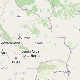


Leaflet | © OpenStreetMap contributors
Time
Current local time in San Borja:
Time: 10:58 -04
Date: 2025-03-21
Sunrise and Sunset
| Date | Sunrise | Sunset |
|---|---|---|
| 2025-03-21 (Today) | 06:30 | 18:38 |
| 2025-03-22 (Tomorrow) | 06:30 | 18:37 |
| 2025-03-23 | 06:30 | 18:36 |
| 2025-03-24 | 06:30 | 18:35 |
| 2025-03-25 | 06:30 | 18:35 |
| 2025-03-26 | 06:30 | 18:34 |
| 2025-03-27 | 06:30 | 18:33 |