
Cities close to Potosí
Cities, towns and suburbs near Potosí. Yamparáez: 79 kilometers (49 miles), Sucre: 80 kilometers (50 miles), Villa Charcas: 156 kilometers (97 miles).
| Cities / towns / suburbs around Potosí | Kilometers | Miles |
|---|---|---|
| How far is Yamparáez from Potosí | 79 | 49 |
| How far is Sucre from Potosí | 80 | 50 |
| How far is Villa Charcas from Potosí | 156 | 97 |
| How far is Villa Serrano from Potosí | 158 | 98 |
| How far is Andamarca from Potosí | 205 | 127 |
| How far is Oruro from Potosí | 231 | 143 |
| How far is Tarija from Potosí | 242 | 150 |
| How far is Cochabamba from Potosí | 248 | 154 |
| How far is Huachacalla from Potosí | 278 | 173 |
| How far is Cruz de Machacamarca from Potosí | 291 | 181 |
Closest airport to Potosí
| Airport | Kilometers | Miles |
|---|---|---|
| Alcantarí Airport (SRE) | 73.6 | 45.7 |
| Jorge Wilstermann International Airport (CBB) | 244.9 | 152.1 |
| Capitán Oriel Lea Plaza Airport (TJA) | 245.4 | 152.5 |
Distance from Potosí to other municipalities
| Municipality | Kilometers | Miles |
|---|---|---|
| How far is Yacuiba from Potosí | 346 | 215 |
| How far is Tupiza from Potosí | 207 | 129 |
| How far is Sucre from Potosí | 80 | 50 |
| How far is San Borja from Potosí | 537 | 333 |
Location
Coordinates:
Latitude: 19°35′0″S
Longitude: 65°45′11″W
Map
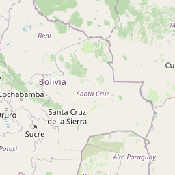


Leaflet | © OpenStreetMap contributors
Time
Current local time in Potosí:
Time: 10:28 -04
Date: 2025-03-21
Sunrise and Sunset
| Date | Sunrise | Sunset |
|---|---|---|
| 2025-03-21 (Today) | 06:26 | 18:33 |
| 2025-03-22 (Tomorrow) | 06:26 | 18:33 |
| 2025-03-23 | 06:26 | 18:32 |
| 2025-03-24 | 06:26 | 18:31 |
| 2025-03-25 | 06:27 | 18:30 |
| 2025-03-26 | 06:27 | 18:29 |
| 2025-03-27 | 06:27 | 18:28 |