
Cities close to Allada
Cities, towns and suburbs near Allada. Houinvigue: 44 kilometers (27 miles), Dogbo: 44 kilometers (27 miles), Lokossa: 48 kilometers (30 miles).
| Cities / towns / suburbs around Allada | Kilometers | Miles |
|---|---|---|
| How far is Houinvigue from Allada | 44 | 27 |
| How far is Dogbo from Allada | 44 | 27 |
| How far is Lokossa from Allada | 48 | 30 |
| How far is Porto-Novo from Allada | 53 | 33 |
| How far is Sakété from Allada | 57 | 35 |
| How far is Abomey from Allada | 60 | 37 |
| How far is Savalou from Allada | 142 | 88 |
| How far is Parakou from Allada | 302 | 187 |
| How far is Djougou from Allada | 343 | 213 |
| How far is Natitingou from Allada | 413 | 257 |
Closest airport to Allada
| Airport | Kilometers | Miles |
|---|---|---|
| Cadjehoun Airport (COO) | 42.9 | 26.7 |
| Lomé–Tokoin International Airport (LFW) | 113.8 | 70.7 |
| Murtala Muhammed International Airport (LOS) | 129.7 | 80.6 |
Distance from Allada to other municipalities
| Municipality | Kilometers | Miles |
|---|---|---|
| How far is Abomey from Allada | 60 | 37 |
| How far is Pobé from Allada | 67 | 41 |
| How far is Savalou from Allada | 142 | 88 |
| How far is Sakété from Allada | 57 | 35 |
| How far is Parakou from Allada | 302 | 187 |
| How far is Savé from Allada | 157 | 97 |
| How far is Lokossa from Allada | 48 | 30 |
| How far is Dogbo from Allada | 44 | 27 |
| How far is Cové from Allada | 65 | 41 |
| How far is Cotonou from Allada | 45 | 28 |
Location
Coordinates:
Latitude: 6°39′55″N
Longitude: 2°9′4″E
Map
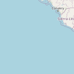


Leaflet | © OpenStreetMap contributors
Time
Current local time in Allada:
Time: 13:26 WAT
Date: 2025-02-23
Sunrise and Sunset
| Date | Sunrise | Sunset |
|---|---|---|
| 2025-02-23 (Today) | 07:04 | 19:04 |
| 2025-02-24 (Tomorrow) | 07:04 | 19:04 |
| 2025-02-25 | 07:04 | 19:04 |
| 2025-02-26 | 07:03 | 19:04 |
| 2025-02-27 | 07:03 | 19:04 |
| 2025-02-28 | 07:03 | 19:04 |
| 2025-03-01 | 07:02 | 19:04 |